
Dolomite Narrows
Team Giddyup
7/29/2011
Here we are at anchor at the Aquatic Park in San Francisco and I have better internet than at the docks in Tofino. Thus, I am finally able to upload some video.
This is mostly underwater footage from our kayak trip through Dolomite Narrows (a.k.a. Burnaby Narrows) in the Haida Gwaii. Most of the footage involved us paddling up current and then drifting over something cool with my hand plunged into the icy cold water with our underwater camera.
After SGaang Gwaii, Dolomite Narrows was my favorite part of the Gwaii Haanas Park.
It's a bit long, quite a bit amateurish, and Windows Movie Maker keeps making the size odd, but if you enjoy underwater life or have an interest in the Haida Gwaii, I think you will enjoy it.
Tofino to SF in images
Team Giddyup
7/27/2011
Last sunset in Tofino
")
Departure morning (excited grins)
")
Leaving Vancouver Island (Lennard Island Lighthouse)
")
Tuna!
")
Tuna sushi
")
Entrance to SF – Bonita Point & Golden Gate
")
Bay sailors
")
Beers on foredeck at arrival in SF (excited, tired grins)
")
Day 6: Sailing under the Golden Gate Bridge
Team Giddyup
7/26/2011
After sailing 667nm over 5 days, the winds finished the spluttering they had begun the night before and died on the morning of the 6th day.
Rather than bobbing around in the shipping lanes hoping any longer, we fired up the Volvo and began motoring toward San Francisco. Bittersweet - we had wished for a rip-roaring sail all of the way to the Golden Gate Bridge but we were excited to be making landfall safely and in good time. Our reward for motoring was plenty of electricity to run the radar full-time the sixth night rather than in timed sweeps. Visibility wasn't great and there were tankers everywhere. Plus, more hot water for showers.
But wait! The wind picked up again after most of a day of motoring and we sailed the last 9 hours into San Francisco. Slowly, very slowly at first, and then briskly under the Golden Gate Bridge to Sausalito where we took a mooring buoy at the yacht club. The white sail on the right side of this picture is us (THANK YOU RYAN!).

Did I mention in the SUN? We've been in Sausalito a few nights now and we've had glorious sun and blue skies every day. We wake to sun and clear skies here but can see the fog over San Francisco and the Golden Gate Bridge every morning but so far it has burned off even in SF by the afternoon.
NUTS & BOLTS
Route: Headed for the Northern approach to SF at approximately 120 degrees magnetic.
Sail plans: Motor and then full main and genoa. Under the bridge with full main only to keep the speed comfortable in case of gusts.
Mileage: 124.1 nm motored and sailed in 32 hours with an average speed of 3.9 knots.
Rather than bobbing around in the shipping lanes hoping any longer, we fired up the Volvo and began motoring toward San Francisco. Bittersweet - we had wished for a rip-roaring sail all of the way to the Golden Gate Bridge but we were excited to be making landfall safely and in good time. Our reward for motoring was plenty of electricity to run the radar full-time the sixth night rather than in timed sweeps. Visibility wasn't great and there were tankers everywhere. Plus, more hot water for showers.
But wait! The wind picked up again after most of a day of motoring and we sailed the last 9 hours into San Francisco. Slowly, very slowly at first, and then briskly under the Golden Gate Bridge to Sausalito where we took a mooring buoy at the yacht club. The white sail on the right side of this picture is us (THANK YOU RYAN!).
Did I mention in the SUN? We've been in Sausalito a few nights now and we've had glorious sun and blue skies every day. We wake to sun and clear skies here but can see the fog over San Francisco and the Golden Gate Bridge every morning but so far it has burned off even in SF by the afternoon.
NUTS & BOLTS
Route: Headed for the Northern approach to SF at approximately 120 degrees magnetic.
Sail plans: Motor and then full main and genoa. Under the bridge with full main only to keep the speed comfortable in case of gusts.
Mileage: 124.1 nm motored and sailed in 32 hours with an average speed of 3.9 knots.
Day 5: We jibed
Team Giddyup
7/23/2011
And on the fifth day, we jibed*.
We went past Cape Mendocino outside of 126W and then jibed to angle toward San Francisco. By late afternoon we also stopped slowing the Estrellita down and allowed her to start doing what a Pretorien likes to do - eat ocean miles**. So we sped through the night until dawn when, just as we were getting cocky about our great weather window choice, the winds dropped, the swell remained high, the sails started popping and we started wallowing along very, very slowly.
We celebrated our anniversary with a porpoise show on our bow, hot showers in the sun and butter chicken.
It was sunny all day and clear skies all night until the morning when the grey and fog returned. I've decided that our feelings about everything are temperature related. Essentially it was the same sailing day today as yesterday but because I could sit outside enjoying it in the sun, it was fantastic.
NUTS & BOLTS
Route: Jibed to approximately 125 degrees magnetic toward entrance to SF. Wind increased throughout the afternoon until we had about 20 knots apparent on average most of the night. Swell has resolved itself to "mostly NW" with a lot of slapping waves from other directions.
Sail plans: Double reefed main and a scrap of genoa, then then double reefed main only, then full main.
Mileage: 133 nm sailed in 24 hours with an average speed of 5.6 knots.
*Non-boating friends, a tack or a jibe are when you change the direction you are heading so that the wind is on the other side of your boat and you also change the sails, keeping them opposite of the wind. While coastal/inland sailing you will usually do this a bunch of times on a short trip, maybe dozens, so it is freaky cool, when sailing offshore in larger weather systems to be able to keep the sails on one side of the boat for almost 5 days.
**OK, she's not a racing sled, but we can pretend, right?
Day 4: California begins
Team Giddyup
7/22/2011
Day 4* started out with some tough family news by SSB and ended with the morning of our 4th year wedding anniversary. A day of personal lows and highs that will be permanently part of our memories of this passage.
Today we passed the Oregon-California barrier about 100nm offshore and celebrated with a bit of 2 Pac & Dr Dre singing California Love.
On a sailing front this was the day of "mostly the sames". We had about the same amount of wind (15 knots apparent), maybe a bit more, from the same direction, maybe a bit farther North. The swell was mostly the same, maybe WNW instead of W. We had sun during the first day and misty wet overnight. Same sail plan.
The same sail plan meant an easy day work-wise for the crew. No sail trimming or changing, only a few tweaks of course to the windvane and Estrellita sailed herself all day towards San Francisco.
Honestly, without the sun, the sailing was a bit boring although we prefer boring to *too* exciting. It's hard to complain that everything is still going just fine, right? Still, it was a day we were both just getting through rather than savoring like the previous few. The nights have been more difficult because there is heavy cloud cover and misty rain. Rather than spending our night watches ogling the moon and stars and wildlife like we did in Hecate Strait, we have been huddled beneath the dodger getting damp and clutching our tea.
We're past the half-way mark. All is well and the weather forecasts look great for continued sailing. We plan to start the engine for 30min or so at some point in the next few days to make sure it still works and so we have some hot water.
NUTS & BOLTS
Route: Began angling back inshore very slightly. See above for wind/swell.
Most common sail plan: Double reefed main and a scrap of genoa.
Mileage: 133.7 nm sailed in 25.5 (forgot to mark at 24) hours with an average speed of 5.2 knots.
*Because we started the trip at 10:30am every "day" is 10:30-10:30.
Playing with the Porpoises
Team Giddyup
7/22/2011
VIDEO FRIDAY
We saw whales, porpoises, birds and all kinds of critters in Hecate Strait but we caught some video of the porpoises. The first video is the underwater show and the second video shows the above water show.
We saw whales, porpoises, birds and all kinds of critters in Hecate Strait but we caught some video of the porpoises. The first video is the underwater show and the second video shows the above water show.
Day 3: Oregon again
Team Giddyup
7/21/2011
It has occurred to me that I've been titling each day according to land borders that are entirely theoretical constructs to us right now. I'm fairly sure I could see some mountains at one point yesterday but otherwise we can't see the coast.
Day 3 has been the best kind of passage day - uneventful. It was sunny except a bit of mist overnight. There has been a nice amount of wind. It is still very rolly, enough so that I have been woken up from a dead sleep slightly in the air from a bad side wave.
Other than a fishing boat that kept trying to dance with us, we've seen almost no traffic. By the Strait of Juan de Fuca and by the Columbia River we say a lot of shipping traffic and last night we were surrounded by tuna boats but today it has mostly been just us out here.
Marge* has been steering since we left the coast of Vancouver Island and so our job is to navigate, keep an eye on the systems of the boat for breakage, tweak Marge or the sails, watch for other boats, download and listen to the weather 4 or so times per day, take care of our bodies, and enjoy. A mellow day on all of those fronts so for the first time this passage, I read a book during part of one of my watches.
NUTS & BOLTS
Route: Still angling slightly offshore to position ourselves outside of the forecast 35 knot winds in a few days in N CA.
Conditions: NW wind in the teens. Swell is slightly more North than West but mostly still a roll factory. Finally reaching all day as we had expected to do from the outset.
Most common sail plan: Double reefed main and a scrap of genoa.
Mileage: 122 nm sailed in 24 hours with an average speed of 5.1 knots.
*Marge is our nickname for our Hydrovane windvane whose tall blue sail reminds us of Marge Simpson's hair.
Day 2: WA & OR Coast
Team Giddyup
7/20/2011
A rainier day yesterday with slightly more difficult sailing winds. The showers marching in from the ocean brought sharp wind increases and then very light winds keeping us on our toes. We both feel less queasy even though the rolling was intense earlier this morning -- enough for the sleeping person to catch some air. Winds have picked up nicely by this morning so things have smoothed out. We've slowed the boat down a bit and have headed a little further offshore this morning to stay clear of some heavier wind expected near the coast tomorrow. The boat is sailing well and we are eating up the miles.
But the important part of the Day 2 was at 10pm last night when we caught a tuna!
You should know that Carol is the fishing instigator in our family. I join in or I help but I don't get the gear out on my own volition. Yesterday, for the very first time I decided to do so. I got out the tuna line still on the rusty cardboard and metal roll and the new green spoon I had picked out and told Carol I was going to catch a tuna. I trailed the line about 100ft behind the boat on the surface. On Carol's next watch he saw a bunch of fishing boats and it made him look at our line and realize we had a fish. After hauling in the tuna we realized we sailed through the night surrounded by dozens of tuna boats each equipped with huge spotlights on their deck. Easy to see and they moved relatively consistently so easy to avoid.
Tuna sushi for lunch today. Pictures of our gorgeous first tuna aboard Estrellita when we get to land.
To watch our progress, click on the "Where are we NOW" link in the box on the upper righthand side of this blog.
NUTS & BOLTS
Route: We had unexpected SW winds most of the afternoon and evening. We had enough sea room to turn slightly toward shore (up to 140 degrees magnetic at one point) to make the ride more comfortable. The forecast was still calling for N or NW winds. By 2am I was able to turn back just offshore of the original course (180M).
Conditions: Mostly SW wind with long periods of under 10 knots. Still a rolly West sail. Mostly close hauled although we switched to a beam and then broad reach in the early hours of the morning.
Most common sail plan: Double reefed main and some amount of genoa.
Mileage: 132 nm sailed in 24 hours with an average speed of 5.5 knots.
Day 1: Southbound from Tofino
Team Giddyup
7/19/2011
Leaving in the "not too distant future" ended up meaning leaving yesterday at 10:30am. Our weather window came earlier than we had kind of hoped, but we spent a day frantically getting ready and we've now finished our first day at sea.
I can't see land. And not because of fog this time. How cool is that?
What a great departure. We had some mild stress related to leaving the marina. A sailboat grounded on its way out of the marina so we delayed our departure an hour or so for a higher tide. We had a bunch of helpful people ready for our undocking in the strong currents and tight docks of the 4th St Wharf but we slipped out easily. After motoring out of the channels from Tofino to the coast of Vancouver Island, we raised our sails and pointed at 126 W. We've been sailing strong ever since.
While hailing friends on the VHF as we sailed away from Canada, three other boats we've met chimed in on the radio to with us safe journey. Thanks to SVs Rosemond, Osprey and Sven for adding a special personal bon voyage to our departure.
I love this boat. If every passage was like yesterday more people would fall in love with passage making.
NUTS & BOLTS
Route: Went to 126W from Tofino. Following it South. Plan to jibe around Cape Mendocino.
Conditions: Mostly West wind averaging about 12 knots (apparent) varying from 7 to 20 with West swell. Rolly. Began 24 hours close hauled, mostly have been sailing beam reach.
Most common sail plan: Double reefed main and double reefed genoa.
Mileage: 146 nm sailed in 24 hours with an average speed of 6.0 knots.
Southbound Excitement
Team Giddyup
7/18/2011
The excitement aboard SV Estrellita 5.10b is building.
Last year we floated through this area in the sun, swimming and dreaming of the next year when we would be in these same areas and about to make our passage to San Francisco.
Carol says: Remember how we were going to leave our Hot Springs Cove board on our way Southbound?
This year, we have been dodging rain and dreaming of Mexico. And right now we are sitting in Tofino, doing chores and waiting for a weather window to head to California.
Livia says: Remember when we were eating ice cream here in Tofino and thinking about how we would leave South from here next year?
Looking forward to heading out into the blue water in the not-too-distant future.
Hot Springs Cove
Team Giddyup
7/17/2011
People who have been reading this blog for a year might remember the gorgeous boardwalk to the hot springs at Hot Springs Cove. When we were there last year, we dreamed of heading South from Tofino and of leaving our board at Hot Springs Cove shortly beforehand. We left our board in Hot Springs – I guess that means we are finally heading South!
We jotted down the dimensions of the boards that boaters have carved last year and as we were leaving our hellacious April haulout, we stowed a board aboard to carve. At Rugged Point we took the kayak to the sandy beach where we were anchored and began carving.
")
")
")
Although many boards are done with professional wood working tools, we enjoyed the boards that were carved by hand and wanted to add to that vibe at the boardwalk. Here is our board half-way finished:
")
And here we are placing it in the boardwalk. If you visit Hot Springs Cove after us, please send us a picture of our board!
")
We spent longer at Hot Springs Cove this trip than we’ve ever stayed anywhere (except a home dock) – 7 nights. It was sunny and our days took on a patter of lazy morning, boat work, a hike and soak in the hot springs, a late dinner and socializing. This year we explored some of the trails. These pictures are from the East side of the peninsula (accessed from a trail that breaks off from the washrooms nearest the dock – on the way to the campground).
")
")
Also, if you visit, don’t miss the trail near the hot springs changing room that leads to a pocket beach where cruisers aboard SV Gia have put up a great swing instead of a plank. You exit the change room toward the hot spring, go left keeping the change room on your left and where the park sign says “no trail/access” keep going straight and left.
UPDATE: 5 years later we were given two copies of our board! Thanks guys!!


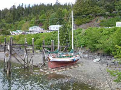
Before and After: Tidal Grids
Team Giddyup
7/16/2011
The extreme tides around here allow boats to use tidal grids to work on their bottom. The idea is that you come near shore on a high tide. Tie your boat to some posts and when the tide goes out you sit on the bottom but don’t fall over because of the posts. It works best with a full keel boat but apparently some people do it with certain types of fin keels as well (yikes). It looks like this:


Rugged Point & Catala Island Marine Park
Team Giddyup
7/15/2011
")
As we left the stump Carol looked over my shoulder toward the trail to the East and saw a bear cub. ")
So…we decided to stay on our side of the beach and carve our board for Hot Springs Cove (more on that later) and also to kayak the gorgeous North side of the point in the sun.
")
")
")
")
")
We spent one night at Catala Island Marine Park which was new to us and has a pretty sand spit. We didn’t explore because the winds were right to continue Southbound and we had decided to move South if the wind was right unless there was sun…there was still no sun. It looked like a very nice place to be on a sunny day. There was a cool skull formation in the rocks too:
")
Kyuquot & The Bunsby Islands
Team Giddyup
7/14/2011
And here begins the anchorage repeats – we visited a number of anchorages on the West Coast of Vancouver Island that we had been to last year. Kyuquot was one. Most things were the same including the unlocked wifi we picked up.
Differences:
- This year there were no burgers at the cafe. The cafe was open but only serving pie (good pie) and coffee.
- We met more people and socialized more this year. We hung out with MV Tropic Isle who fed us salmon and SV Sally Goodn who donated a prawn trap to our fishing kit (THANK YOU!).
- We also enjoyed some hang out time and a fishing expedition on MV Last Mango which was a raging success. We caught and released a lot of fish but kept a load of salmon. We have been eating salmon, salmon pate, salmon pies and more salmon.
")
")
")
The Bunsby Islands were a bust this year. We loved them last year and spent 8 nights in two anchorages kayaking and working on the boat in the sun. This year we had rain, rain and more rain. The good news is that we were rained in with other fun boats and so spent time commiserating aboard SV Bella Star and SV Rosemond.
Passage: Cape St James to Kyuquot
Team Giddyup
7/11/2011
")
We left straight from SGaang Gwaay to sail past Cape St James (above) which is the Southern tip of the Haida Gwaii (well, except for some islands). We sailed through the first night and that next day we had to ditch our plans to go back to San Josef Bay which we loved but which is a crap anchorage when a SW swell is running and it was.
We decided to go to Winter Harbour but throughout the day the winds were lighter than forecast and although we were sailing, we were traveling slower than expected and we knew we wouldn’t make Winter Harbour by dark. The winds picked up in the evening and we decided to take advantage of the lovely NW wind to continue sailing through a second night, rounding the Brooks Peninsula and arrive at dawn at Kyuquot…which we did.
The challenge of this passage was to keep the sails from popping when we had swell coming from two directions at two different periods. We ended up running with our main only for part of the trip because the winds were around 120 degrees on a starboard tack and when the two swells combined to roll us heavily to port the jib would deflate and then inflate with a crack and a shock to the rig. Besides the use of the preventer, we also tried bungee cord on the mainsheet to minimize mainsail popping and on one watch I sat on the cockpit combing with my hand on the mainsheet and pulled on the mainsheet when it slacked to keep tension and reduce the popping (this worked except on the worst rolls).
Ideas?
43.5 hours and 200nm averaging 4.6 knots.
Southbound prep: NOAA weather regions
Team Giddyup
7/10/2011
California dreamin…

We are looking into options for extended stays in one or more places in California (a few weeks to a month). If anyone has any insider knowledge, please send us an email.

We are looking into options for extended stays in one or more places in California (a few weeks to a month). If anyone has any insider knowledge, please send us an email.
Before and After: Motoring in the swell
Team Giddyup
7/09/2011
This is a good visual example of motoring in calm winds and a swell. The photos are of friends aboard SV Wecantu while we were rounding Cape Caution. Watch the bow rise and dive.
")
")
Book: The Curve of Time
Team Giddyup
7/07/2011
The Curve of Time is a classic cruising book for the BC/WA area. The author and her husband bought a boat intending to take their children cruising and one day the husband went out with the boat and never returned. The boat was found but he wasn't. She took her children out on that boat alone every summer during the remainder of their childhood and she visited now well known places before they became popular.
The writing style wasn't my favorite and she occasionally branches off into a fantasy world. Each time that happened I started skimming until she was back to her travel tale. Still, I loved reading about Desolation Sound and Princess Louisa Inlet before they were discovered by cruising boats.
Used copies are cheap and friends lent me a copy. I would definitely recommend it as a book to read if you are heading to either of the primary places she describes (Desolation, Princess Louisa) or if you cruise with children.
Logbook: Gwaii Haanas - Ending with “The Bad" and “The Ugly”
Team Giddyup
7/06/2011
Strange to end our log of the park with a bunch of bays that I’m NOT going to post about in detail but here it is.
")
We came with an expectation of wild, natural beauty; For the most part we experienced second growth logged (?) islands and a startling lack of wildlife. No old growth forests, very few critters. We saw eagles and a handful of seals but very little above water life and with exceptions that I’ll write about separately we saw very little underwater life as well. We have seen many, many more animals in Desolation Sound and on the West Coast of Vancouver Island than we did here. We saw tons of marine mammals in Hecate Strait but not in Gwaii Haanas. Where were the lush forests? Where was the teeming life in the brochures and books?
The trip quickly became focused on a few must-do places and skipping everything in between…
…because most anchorages we visited here were blah. Who wants to cope with the colder wetter climate of the Haida Gwaii for blah anchorages? Nothing sucked per se, but without finding “the wild” that we had hoped for we started moving quickly, stopping only at locations that had something unique (Haida village sites, lush underwater life at Dolomite Narrows, hot springs).
Anchorages that were OK: Thurston, Kostan, Matheson.
Anchorages that were nice but not better than you would find around Vancouver Island: Island Bay, Murchison, Hoya Passage
Logbook: SGaang Gwaay
Team Giddyup
7/05/2011
") We anchored in the SE cove on a day when the winds were blowing from the NW. We planned to take advantage of those winds by leaving directly from the village site for a two day passage to Vancouver Island.
We anchored in the SE cove on a day when the winds were blowing from the NW. We planned to take advantage of those winds by leaving directly from the village site for a two day passage to Vancouver Island.Because of the passage we had packed away the dinghy and motor and we used the kayak to come to shore. A modern echo of the wooden canoe.
") SGaang Gwaay is easily the most beautiful island we visited in the entire park and although I wish we could anchor there I’m glad that it is being preserved.
SGaang Gwaay is easily the most beautiful island we visited in the entire park and although I wish we could anchor there I’m glad that it is being preserved.The woods were lush in a Tofino area kind of way and the Haida Watchman Patrick took just the two of us on a tour of the village site.
The village itself is fronted by a gorgeous small cove in which they fished, collected shellfish and used long stone slides in the water to pull their canoes up to the beach at low tide.
I would love to have spent the night anchored there but it is no longer allowed which is great because could you imagine listening to someone’s generator while viewing the poles??
")
When you put your back to the cove you see a line of poles that were in front of a line of longhouses. All of the primary frontal poles (the tallest) were taken by museums in the past and what remains are clan chief poles and mortuary poles in various states of decomposition.
")
Some efforts were made in the past to support the poles but the Haida Band Council made the decision to allow the poles to return to the earth and so the only preservation tactics still used are trimming of the plants that take root and begin growing in the poles.
")
")
The area is pounded by SE gales and so all of the poles show strong weather on the SE side and much crisper carving remains on the NW side.
")
")
")
")
The longhouses are fallen and are covered with grass and moss. This is the last standing join.
")
Cedar is rich material for other plants and so in many areas you can see where either totem poles or support beams for the longhouses have been used as a nursery log for what is now an enormous tree (left). The mortuary poles had human remains in boxes in a cavity in the top and these cavities were protected with face boards (now gone – many in museums) and cedar bark roofs. Now that the cavities are open, they host plant life and birds (right).
")
")
This was the highlight of the Haida Gwaii trip by far.


